
Affichage de 867 résultats
Description archivistique431 résultats avec objets numériques Afficher les résultats avec des objets numériques
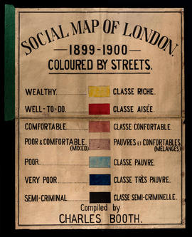
Charles Booth Digitised Archive
Charles Booth Digitised Archive
BOOTH/B/314-Notebook: Clergy District 47 [Sydenham; Lewisham; Eltham and Lee]
BOOTH/B/314-Notebook: Clergy District 47 [Sydenham; Lewisham; Eltham and Lee]
UKLSE_DL1_CB01_002_001_0306_0001.pdf
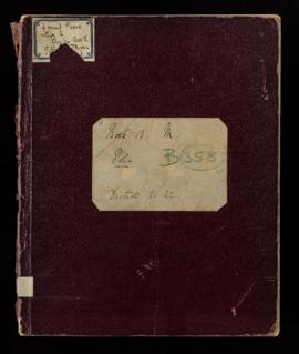
BOOTH/B/351-George H. Duckworth's Notebook: Police and Publican District 7 [Mile End Old Town and Spitalfields]; District 8 [Aldgate;St George's in the East; Shadwell]; District 9 [Bethnal Green;North and South]
BOOTH/B/351-George H. Duckworth's Notebook: Police and Publican District 7 [Mile End Old Town and Spitalfields]; District 8 [Aldgate;St George's in the East; Shadwell]; District 9 [Bethnal Green;North and South]
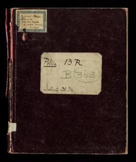
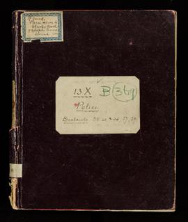
BOOTH/B/354-George H. Duckworth's Notebook: Police District 2 [Strand and St Giles]; District 3 [St James; Westminster; Soho; All Saints and Tottenham Court Road]; District 4 [Clerkenwell and Gray's Inn]
BOOTH/B/354-George H. Duckworth's Notebook: Police District 2 [Strand and St Giles]; District 3 [St James; Westminster; Soho; All Saints and Tottenham Court Road]; District 4 [Clerkenwell and Gray's Inn]
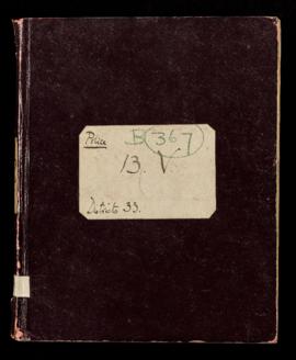
BOOTH/B/356-Ernest Aves' Notebook: Police District 18 [Somers Town and Camden Town]; District 19 [Kentish Town]
BOOTH/B/356-Ernest Aves' Notebook: Police District 18 [Somers Town and Camden Town]; District 19 [Kentish Town]
UKLSE_DL1_CB01_002_001_0317_0001.pdf
BOOTH/B/362-[Arthur L. Baxter's ?] Notebook: Police District 24 [St John Westminster]; District 25 [St Margaret and Belgrave]; District 26 [Chelsea]; District 27 [Brompton]
BOOTH/B/362-[Arthur L. Baxter's ?] Notebook: Police District 24 [St John Westminster]; District 25 [St Margaret and Belgrave]; District 26 [Chelsea]; District 27 [Brompton]
UKLSE_DL1_CB01_002_001_0322_0001.pdf
UKLSE_DL1_CB01_002_001_0326_0001.pdf
UKLSE_DL1_CB01_002_001_0328_0001.pdf
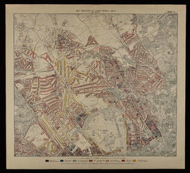
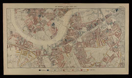
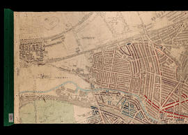
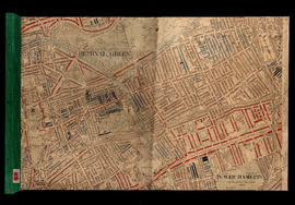
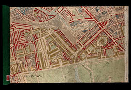
BOOTH/E/1/1-Printed Map Descriptive of London Poverty 1898-1899. Sheet 1. Eastern District
BOOTH/E/1/1-Printed Map Descriptive of London Poverty 1898-1899. Sheet 1. Eastern District
UKLSE_DL1_CB01_003_001_0004_0001.jpg
UKLSE_DL1_CB01_003_001_0006_0001.jpg
UKLSE_DL1_CB01_003_001_0008_0001.jpg
UKLSE_DL1_CB01_003_001_0010_0001.jpg
UKLSE_DL1_CB01_004_001_0001_0001.jpg
UKLSE_DL1_CB01_004_001_0003_0001.jpg
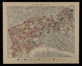
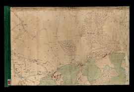
BOOTH/E/2/5-Coloured Map Descriptive of London Poverty 1898-1899 Sheet 20 - Stroud Green, Ferme Park, Finsbury Park
BOOTH/E/2/5-Coloured Map Descriptive of London Poverty 1898-1899 Sheet 20 - Stroud Green, Ferme Park, Finsbury Park
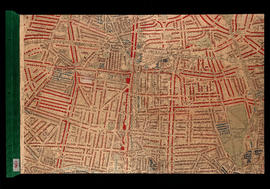
BOOTH/E/2/7-Hand Coloured Map Descriptive of London Poverty 1898-1899 Sheet 22 - Walthamstow Marshes
BOOTH/E/2/7-Hand Coloured Map Descriptive of London Poverty 1898-1899 Sheet 22 - Walthamstow Marshes
BOOTH/E/2/9-Hand Coloured Map Descriptive of London Poverty 1898-1899 Sheet 27 - Hampstead Heath, Rosslyn Park
BOOTH/E/2/9-Hand Coloured Map Descriptive of London Poverty 1898-1899 Sheet 27 - Hampstead Heath, Rosslyn Park
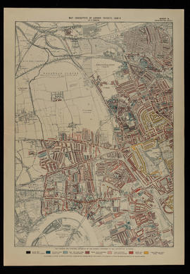
BOOTH/E/2/10-Hand Coloured Map Descriptive of London Poverty 1898-1899 Sheet 28 - Parliament Hill, Dartmouth Park, Upper Holloway, [Gospel Oak], Tufnell Park
BOOTH/E/2/10-Hand Coloured Map Descriptive of London Poverty 1898-1899 Sheet 28 - Parliament Hill, Dartmouth Park, Upper Holloway, [Gospel Oak], Tufnell Park
UKLSE_DL1_CB01_004_001_0018_0001.jpg
UKLSE_DL1_CB01_004_001_0020_0001.jpg
UKLSE_DL1_CB01_004_001_0024_0001.jpg
BOOTH/E/2/26-Hand Coloured Map Descriptive of London Poverty 1898-1899 Sheet 53 - West Ham, Mill Meads, Bromley, Bow
BOOTH/E/2/26-Hand Coloured Map Descriptive of London Poverty 1898-1899 Sheet 53 - West Ham, Mill Meads, Bromley, Bow
BOOTH/E/2/27-Hand Coloured Map Descriptive of London Poverty 1898-1899 Sheet 59 - Notting Hill, St Quintin Park, North Kensington, Westbourne Green
BOOTH/E/2/27-Hand Coloured Map Descriptive of London Poverty 1898-1899 Sheet 59 - Notting Hill, St Quintin Park, North Kensington, Westbourne Green
UKLSE_DL1_CB01_004_001_0028_0001.jpg
Résultats 1 à 28 sur 867