
Mostrando 867 resultados
Descripción archivística431 resultados con objetos digitales Muestra los resultados con objetos digitales
UKLSE_DL1_CB01_002_001_0314_0001.pdf
UKLSE_DL1_CB01_002_001_0321_0001.pdf
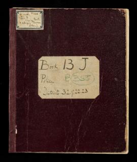
BOOTH/B/364-Ernest Aves' Notebook: Police District 32 [Trinity Newington and St Mary Bermondsey]
BOOTH/B/364-Ernest Aves' Notebook: Police District 32 [Trinity Newington and St Mary Bermondsey]
UKLSE_DL1_CB01_002_001_0323_0001.pdf
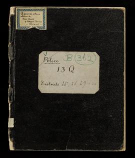
BOOTH/B/365-George H.Duckworth's Notebook: Police District 32 [Trinity Newington and St Mary Bermondsey]; District 33 [St James Bermondsey and Rotherhithe]; District 34 [Lambeth and Kennington];District 35 [Kennington (2nd) and Brixton]; District 41 [St Peter Walworth and St Mary Newington]; District 42 [St George Camberwell]; District 45 [Deptford]
BOOTH/B/365-George H.Duckworth's Notebook: Police District 32 [Trinity Newington and St Mary Bermondsey]; District 33 [St James Bermondsey and Rotherhithe]; District 34 [Lambeth and Kennington];District 35 [Kennington (2nd) and Brixton]; District 41 [St Peter Walworth and St Mary Newington]; District 42 [St George Camberwell]; District 45 [Deptford]
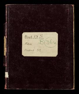
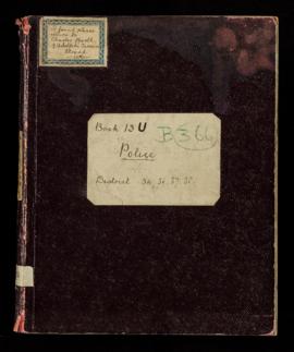
BOOTH/B/366-[Arthur L Baxter ?]Notebook: Police District 34 [Lambeth and Kennington]; District 36 [Battersea East]; District 37 [Battersea West]; District 38 [Clapham]
BOOTH/B/366-[Arthur L Baxter ?]Notebook: Police District 34 [Lambeth and Kennington]; District 36 [Battersea East]; District 37 [Battersea West]; District 38 [Clapham]
UKLSE_DL1_CB01_002_001_0325_0001.pdf
UKLSE_DL1_CB01_002_001_0331_0001.pdf
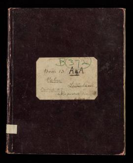
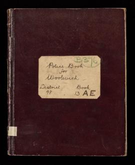
BOOTH/B/376-George H.Duckworth's Notebook: Police District 48 [Woolwich]
BOOTH/B/376-George H.Duckworth's Notebook: Police District 48 [Woolwich]
UKLSE_DL1_CB01_002_001_0335_0001.pdf
UKLSE_DL1_CB01_003_001_0003_0001.jpg
BOOTH/E/1/4-Printed Map Descriptive of London Poverty 1894-1899. Sheet 4. North Western District
BOOTH/E/1/4-Printed Map Descriptive of London Poverty 1894-1899. Sheet 4. North Western District
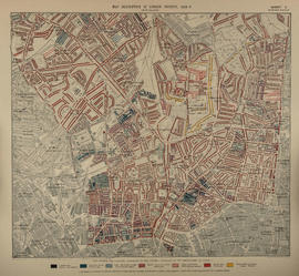
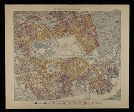
BOOTH/E/1/5-Printed Map Descriptive of London Poverty 1898-1899. Sheet 5. East Central District
BOOTH/E/1/5-Printed Map Descriptive of London Poverty 1898-1899. Sheet 5. East Central District
UKLSE_DL1_CB01_003_001_0005_0001.jpg
UKLSE_DL1_CB01_003_001_0007_0001.jpg
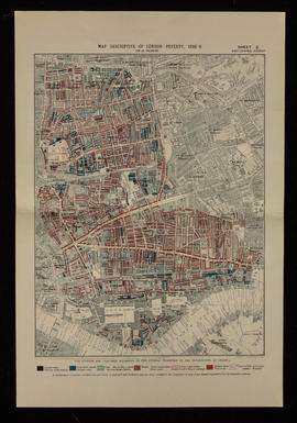
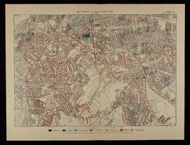
BOOTH/E/1/8-Printed Map Descriptive of London Poverty 1898-1899. Sheet 8. Outer Western District
BOOTH/E/1/8-Printed Map Descriptive of London Poverty 1898-1899. Sheet 8. Outer Western District
UKLSE_DL1_CB01_003_001_0011_0001.jpg
BOOTH/E - Maps Descriptive of London Poverty: hand-coloured
BOOTH/E - Maps Descriptive of London Poverty: hand-coloured
UKLSE_DL1_CB01_004_001_0002_0001.jpg
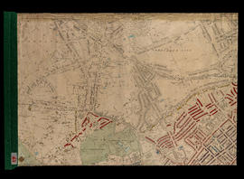
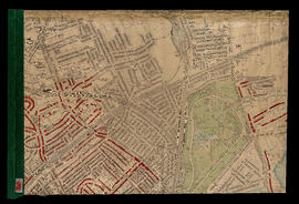
BOOTH/E/2/4-Hand Coloured Map Descriptive of London Poverty 1898-1899 Sheet 19 - Highgate, Shepherd's Hill, Crouch Hall Park, Waterlow Park
BOOTH/E/2/4-Hand Coloured Map Descriptive of London Poverty 1898-1899 Sheet 19 - Highgate, Shepherd's Hill, Crouch Hall Park, Waterlow Park
UKLSE_DL1_CB01_004_001_0004_0001.jpg
UKLSE_DL1_CB01_004_001_0005_0001.jpg
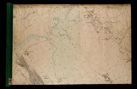
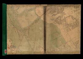
BOOTH/E/2/6-Hand Coloured Map Descriptive of London Poverty 1898-1899 Sheet 21 - Stamford Hill, Walthamstow Marshes (part), Upper Clapton
BOOTH/E/2/6-Hand Coloured Map Descriptive of London Poverty 1898-1899 Sheet 21 - Stamford Hill, Walthamstow Marshes (part), Upper Clapton
UKLSE_DL1_CB01_004_001_0007_0001.jpg
UKLSE_DL1_CB01_004_001_0010_0001.jpg
UKLSE_DL1_CB01_004_001_0011_0001.jpg
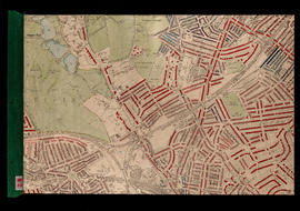
BOOTH/E/2/12-Hand Coloured Map Descriptive of London Poverty 1898-1899 Sheet 30 - Stoke Newington, South Hornsey, Clissold Park, Clapton and Hackney Downs
BOOTH/E/2/12-Hand Coloured Map Descriptive of London Poverty 1898-1899 Sheet 30 - Stoke Newington, South Hornsey, Clissold Park, Clapton and Hackney Downs
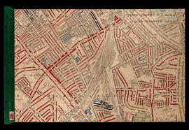
BOOTH/E/2/13-Hand Coloured Map Descriptive of London Poverty 1898-1899 Sheet 31 - Leyton Marshes, Lower Clapton, Hackney, Hackney Marsh and Clapton Park
BOOTH/E/2/13-Hand Coloured Map Descriptive of London Poverty 1898-1899 Sheet 31 - Leyton Marshes, Lower Clapton, Hackney, Hackney Marsh and Clapton Park
Resultados 421 a 448 de 867